
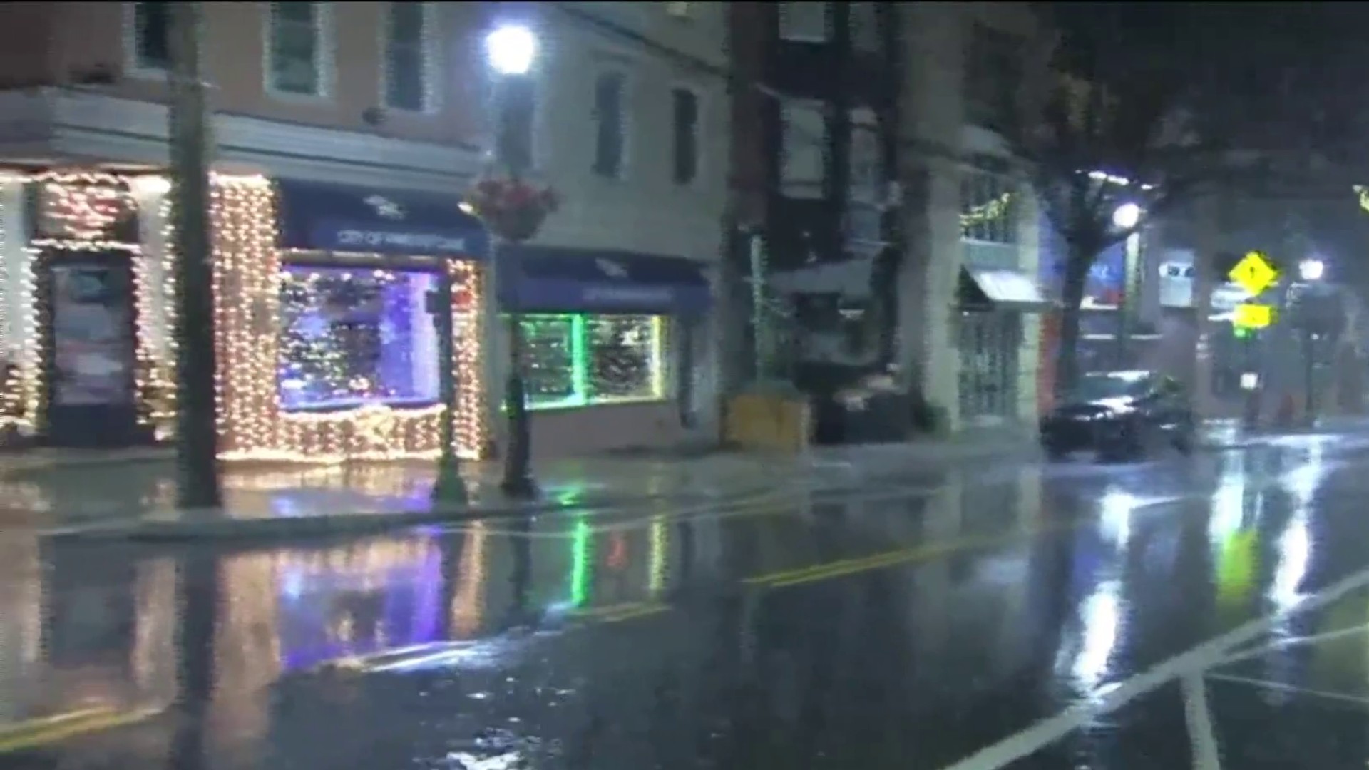
Heavy rain, flooding and strong winds struck the entire Philadelphia region through midday Monday.
A First Alert for the flooding due to heavy rains and possible damage from strong winds has expired.
Give yourself extra time on roads
Get Philly local news, weather forecasts, sports and entertainment stories to your inbox. Sign up for NBC Philadelphia newsletters.
The best bet heading into Tuesday morning is to give yourself extra time to get where you're going as there are many roads still closed due to the flooding.
"Allow for a lot of extra time," meteorologist Bill Henley said.
Remember to turn around and not drown.
What to expect from the storm
Sunday started cloudy and dreary with some areas of drizzle and showers that gradually started to pop up by late morning and early afternoon. The rain became more widespread by dinnertime and then intensified during the evening.
The heaviest rainfall had passed by Monday morning, but rain continued throughout the morning.
Much of the region got multiple inches of rain, with some areas getting more than 4 inches. More than 5 inches of rain fell in Lewes and Delmar in Delaware and near Avondale in Chester County, according to the National Weather Service.
These are the top rainfall totals (in inches) in counties throughout the tri-state:
- Atco (Camden County) - 3.41
- (Near) Avondale (Chester County) - 5.49
- Bridgeton (Cumberland County) - 3.31
- Buckingham (Bucks County) - 3.65
- Delmar (Sussex County) - 5.34
- Dover (Kent County) - 3.89
- Estell Manor (Atlantic County) - 4.74
- Fogelsville (Lehigh County) - 3.84
- Furlong (Bucks County) - 4.11
- Hopewell (Mercer County) - 3.27
- Lake Harmony (Poconos) - 3.64
- Lakewood (Ocean County) - 3.25
- Portland (Northampton County) - 4.32
- Salem (Salem County) - 3.34
- Sinking Spring (Berks County) - 3.71
- Snydersville (Poconos) 4.58
- Tabernacle (Burlington County) - 4.61
- Thornton (Delaware County) - 3.76
- Turnersville (Gloucester County) - 4.42
- Willow Grove (Montgomery County) - 3.64
- Wilmington (New Castle County) - 3.5
- Woodbine (Cape May County) - 3.54
About 3 inches of rain fell at Philadelphia International Airport, according to the National Weather Service.
This ongoing precipitation added to the existing challenges on the roads, with notable ponding. Additionally, rivers and streams in the area continued to rise, posing a flooding risk into Monday night and early Tuesday for some neighborhoods.
The flooding concern was greatest along areas that may be vulnerable to flood, like creeks, rivers, urban areas. Also, there could be flooding along the Jersey Shore coastline as winds moving onshore bring water into the low-lying areas.
Wind gusts of up to 40 mph are possible in Philadelphia and and areas away from the coastline. But, along the Jersey Shore, gusts peaking near 50 mph could be possible along the coast -- isolated gust could reach up to 60 mph.
Roads flood, slowing drivers
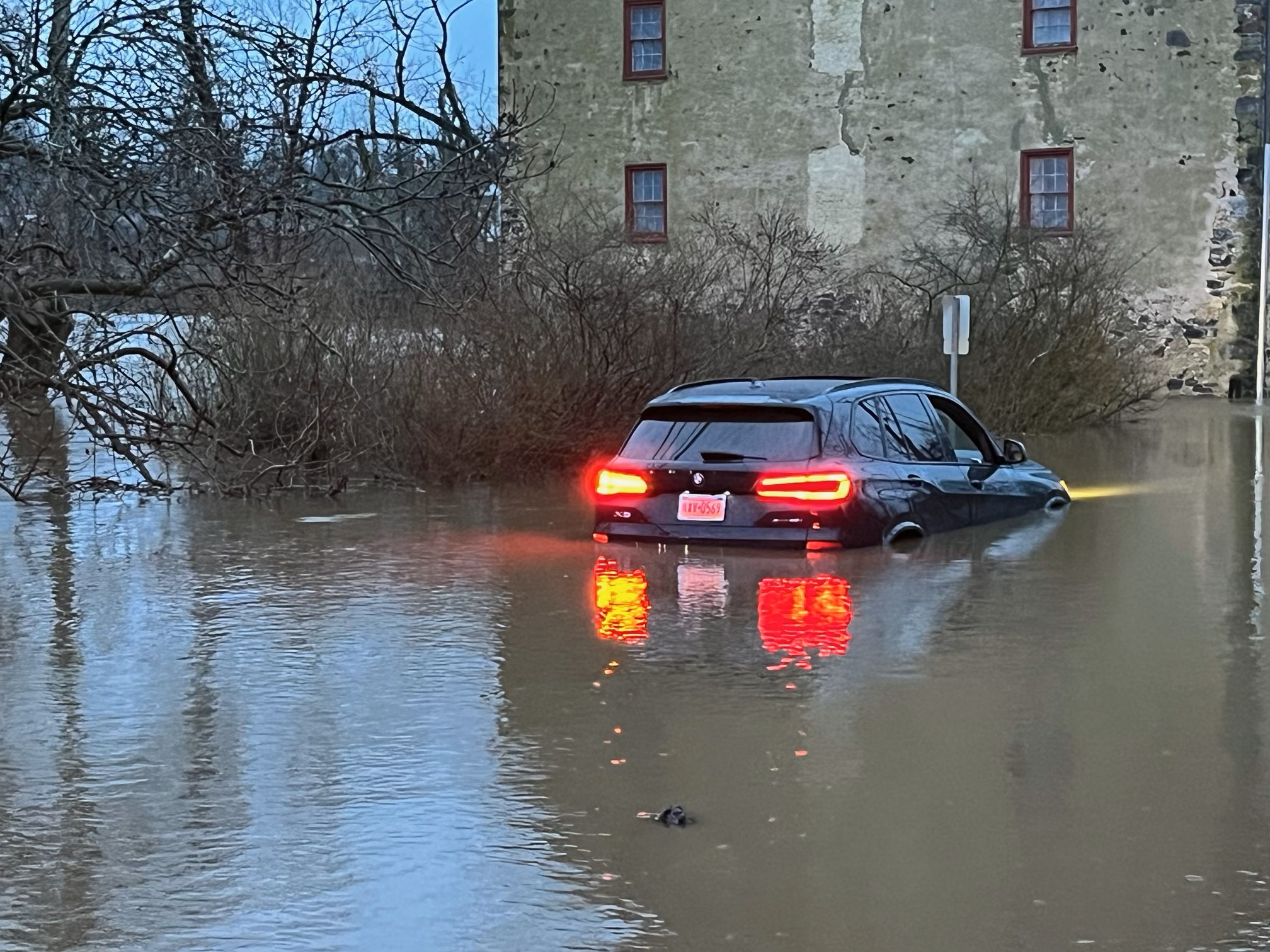
Monday morning there were reports of dozens of vehicles caught on flooded streets from Camden and Pennsauken in South Jersey to the Pennsylvania suburbs. Some people had to be rescued from their cars with more than one dozen rescues reported across the suburban counties.
In Philadelphia, cars plowed through standing water along the Kelly Drive. And, water on the highway slowed drivers on the Schuylkill Expressway.
Before daybreak, water had flooded onto Columbus Boulevard by Race Street, leading to the roadway being blocked off. Some lanes remained closed later in the morning as crews worked to clean up the mess left by the floodwater.
Philadelphia's Kelly Drive was also closed for hours from Midvale Avenue to South Ferry Road due to flooding. Parts of the road remained closed Tuesday morning.
The most severe flooding was reported early Monday in parts of Chester County and Montgomery County. In Montgomery County, the Perkiomen Creek at Graterford experienced moderate flooding. There was also concern about the East Branch of the Brandywine Creek below Downingtown, which was undergoing moderate flooding with the potential to escalate.
A driver had to be rescued from a submerged car along the Wissahickon Creek in Whitemarsh Township Monday morning.
By Monday night another sinkhole in Chester County opened up along Route 29. The northbound lanes are closed at Route 29 and Atwater Drive while crews work through the night on repairs.
In the Camden area, school buses were among the vehicles that could be seen flooded out. And, down the shore there was flooding near the bay in Margate, New Jersey.
Flood warnings along creeks -- including the Brandywine below Downingtown -- remain in effect into the evening.
Several schools deal with flooding concerns
Germantown Academy in Fort Washington, Montgomery County, closed Monday due to flooding.
"Due to serious flooding concerns on the roads and multiple access points being closed, GA will be CLOSED today, Monday, December 18," a message on the private school's website said.
Several other schools in the region planned to open later Monday due to the heavy rain and flooding concerns.
Get our list of school closings and delays.
Temps drop after storm
Once the storm passed Monday midday, the wind shifted direction and a westerly, northwest wind dropped temps and drier air filtered in. High temps Monday -- in the low 60s or high 50s -- happened early in the morning and temps fell throughout the day.
After the rain, we experienced gusty winds and partly cloudy skies, with temperatures dropping to the low 50s. However, a shift to colder and blustery conditions is expected by Monday night.
By Tuesday, temperatures will be around 40 degree and will feel more like below freezing.
Additionally, there's a possibility of spotty snow showers early Tuesday morning in the Lehigh Valley and Pocono Mountains, though little to no accumulation is expected.
Download the NBC10 app and follow the NBC10 First Alert Weather Team to get the latest weather updates.
Sign up for our Breaking newsletter to get the most urgent news stories in your inbox.
