
What to Know
- The NBC10 First Alert Weather Team has issued a FIRST ALERT through Saturday night for dangerous cold that followed a disruptive and difficult storm.
- After plenty of rain Thursday, temps plunged Friday leading to some snow before dry, bitter cold temps took hold.
- Bitter cold temperatures continue through Christmas weekend. The extreme cold Saturday put a big strain on the power grid.
The NBC10 First Alert Weather Team has issued a FIRST ALERT, that is in effect until Saturday night, for the dangerously cold conditions that followed a storm that brought rain, ice, snow and damaging winds to the region.
Temps will be feeling below zero or in the single digits for most of Christmas Eve, putting a strain on any skin exposed and the power grid.
Here is the latest on the changing weather conditions:
Get Philly local news, weather forecasts, sports and entertainment stories to your inbox. Sign up for NBC Philadelphia newsletters.
Plunging Temps, Power Concerns
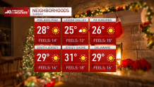
As the sun rose on Saturday morning, the high in Philly was just 8 degrees with winds gusting up to 23 mph making it feel like -13. Sub-zero feels-like temps were felt from the Poconos down to Rehoboth Beach, Delaware.
Though it warmed slightly during the day Saturday, temps continued to feel like the single digits, at best.
So, bundle up and be sure to keep your pets warm and check on the elderly. You should also limit time outdoors and have a vehicle safety kit in your car.
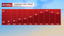
Brutal cold is the big story through all of Christmas weekend. The coldest Christmas since 1989 is expected. The most intense and painful cold will be felt through Saturday morning. The blustery and painfully cold wind continues during the day Saturday (Christmas Eve).
Around 6 a.m. Friday, temperatures were in the low 50s, but as the arctic blast arrived, temperatures plunged into the 20s during the afternoon and dropped into the single-digits overnight.
That's right. At 1 a.m. Friday, the high in Philly was 59 degrees. By 11 p.m. Friday it was in the single digits.
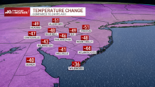
It felt even colder with sub-zero feels-like temps.
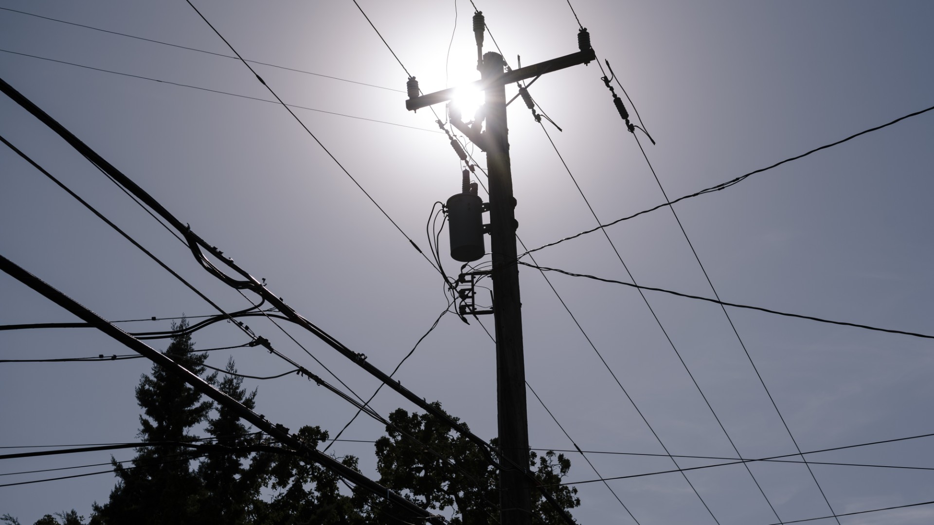
All these cold temps put a strain on the power grid along the East Coast. PJM warned of power outages and urged people to conserve energy in their homes: turn off lights, don't run large electronics and turn down the thermostat - if health permits.
Power Outages
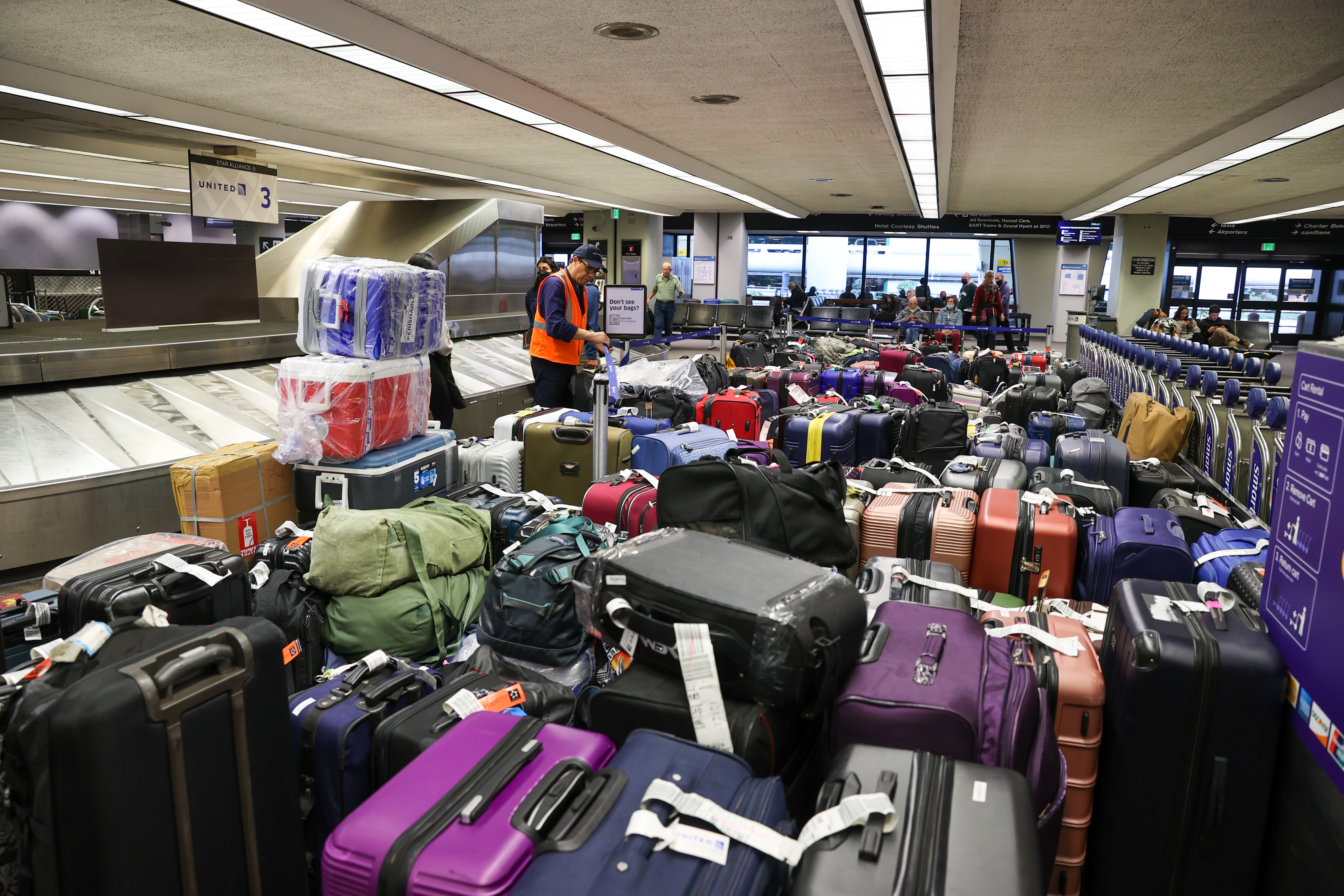
Wind gusts were strong early Friday evening. Due to the saturated ground, some of these gusts may topple trees causing power outages. By 1:45 p.m., almost 17,000 PECO customers were without power. As of 8:30 p.m., PECO reported a little over 9,000 outages.
Thousands of scattered outages were reported Saturday morning.
Cold Christmas
Christmas Day will still be extremely cold, but not quite as intense as Saturday, so the FIRST ALERT will expire Saturday evening.
The estimated high for Christmas is still well above the 10 degree record set in 1983, but still below freezing and feeling like the teens through the day.
Rain Changing to Snow
The storm already hit parts of the upper Midwest with sub-zero wind-chill and blizzard conditions. Snowfall like that didn't happen in the Philadelphia region.
Although steady rain tapered off overnight, rain that moved in from the west, changed over to snow as a blast of cold arctic air arrived by late morning on Friday.
Bands of gusty snow showers with briefly low visibility fell in parts of the area on Friday. Snow accumulations were little to none outside of where snow squalls hit. Any snow or rain that didn't dry out, froze as the evening went on.
By midafternoon, winds already began pushing out the snow and the sun even sometimes broke through the clouds.
Warmer Days Ahead
It sure doesn't seem like it Saturday morning, but warmer days are on the horizon with temps pushing into the upper 50s and even 60s as 2022 turns to 2023.
Be sure to charge your devices and download the free NBC10 app to get the latest weather updates and forecast for your neighborhood.
