
What to Know
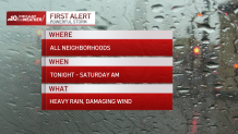
- A First Alert is in effect for the entire Philadelphia region Friday night into Saturday morning due to a powerful storm bringing heavy rain, possible flooding and damaging winds.
- Wind gusts of 50 mph are possible from Philadelphia and the I-95 Corridor to the Jersey Shore. Blustery conditions continue into Saturday as temps dip.
- Stay with the NBC10 First Alert Weather team for the latest updates during and after the storm.
As the region recovers from Tuesday’s damaging storm, another system bringing heavy rain, strong winds and potential flooding raced toward our area.
A First Alert has been issued for the entire Philadelphia region from Friday night into Saturday morning for the risks of heavy rain, flooding and damaging winds.

Get Philly local news, weather forecasts, sports and entertainment stories to your inbox. Sign up for NBC Philadelphia newsletters.
The storm was moving quickly across the Midwest Friday and was expected to move through the Philadelphia region faster than the last storm.
How much rain will fall? When will it start?
Light rain was anticipated toward the end of the Friday evening commute. Then, the heaviest downpours are expected from late Friday night into very early Saturday morning.


Not as much total rainfall is expected, however it will likely be enough to cause more flooding with rivers, creeks and streams already high.
Rain totals from the approaching storm will be from half an inch at the Jersey Shore to as much as 2 inches in the Philadelphia suburbs.
“Though it may not seem like a lot, it won’t take much or take long to begin to see more flooding issues,” NBC10 First Alert Weather meteorologist Michelle Rotella said. “Strong to damaging winds are also on the table once again.”
The hardest rain should wrap up before daybreak, though some spotty showers could fall during the morning.
How strong will the wind be? Where is flooding most likely?
Wind gusts could reach up to 50 mph from the Jersey Shore to Philadelphia, Wilmington, Trenton and surrounding neighborhoods. With loose soil from previous stormy weather, trees can topple and power lines could come down.
Flood watches and coastal flood watches have already been issued for parts of our region. (See the full list of watches and warnings here)
The worst of the flooding is expected along the Barnegat Bay in South Jersey and along the tidal Delaware River due to overnight high tide. The coastal flood threat continues through Saturday afternoon's high tide.
However, people could see pockets of flooding and ponding on roadways in the susceptible low-lying areas throughout the region.
Strong wind gusts continue on a blustery Saturday as temperatures dip. Feel's like temps in the afternoon will be in the 30s, so plan to bundle up.
Countywide emergency in Burlington County, NJ
The Burlington County Office of Emergency Management declared a countywide state of emergency ahead of the storm and is encouraging residents who were already impacted by flooding from Tuesday's storm to voluntarily evacuate.
“We’re bracing for more rain, strong winds and potential for more severe flooding,” said Burlington County Commissioner Deputy Director Dan O’Connell. “Our emergency management teams and first responders are making preparations, but in the interest of everyone’s safety, we’re asking residents in our previous flood zones to voluntarily evacuate in order to avoid putting lives at risk.”
In Delran, New Jersey, many residents are still recovering from flooding that occurred on Tuesday and Wednesday when the Delaware River reached a record high of 11.9 feet.
A Red Cross shelter is open at the Delran Firehouse at 9 South Bridgeboro Street and county officials are prepared to open a second, larger shelter if necessary.
Tips to stay safe during and after a storm
Utilize these tips to stay safe:
During a storm, if you notice water rising or plan to evacuate:
- Unplug all electrical appliances.
- Shut off natural gas supply valve to any gas appliances. The valve is usually found on the gas line to the appliance.
What to do if your home or business is flooding?
- Don't touch any appliance in standing water.
- If you can do so safely, turn off any air conditioning or major appliances that may have been running when outage occurred. This will help avoid a power surge.
- Call local electric company or 911 if you smell gas.
- Don't go into basements with standing water, raw sewage or obvious electric hazards. Stay away from breaker box.
- Watch out for animals or snakes that may have been flooded out of their homes and are seeking shelter.
Be prepared for whatever Mother Nature brings
Be sure to watch NBC10 News and download the NBC10 app to get the latest forecasts, live radar and any weather alerts to help you stay safe during the storm. Having the app can also keep you updated if you lose power.
Sign up for our Breaking newsletter to get the most urgent news stories in your inbox.
