
The shore town of Ocean City, New Jersey, will become more ocean and less town during the next three decades, according to a new report on coastal flooding by the National Oceanic and Atmospheric Administration, which says sea levels will rise 10-12 inches along the East Coast by 2050.
That has residents and business owners like Jennifer Bailey worried about how sustainable the future will be for her town.
"We make all this product and then we lose it all because no one can get to us," Bailey, a coffee shop proprietor, said of flooding that already occurs following storms and during several high tides each year.
Ocean City is already surrounded by water, sitting on a barrier island off the New Jersey mainland just south of Atlantic City. On average, the town is about 3 feet above the current sea level.
Get Philly local news, weather forecasts, sports and entertainment stories to your inbox. Sign up for NBC Philadelphia newsletters.
That will not be the case in 2050, according to the NOAA report released this week. The ocean along the East Coast will rise a few inches each of the next three decades, the report's findings say, reaching about a foot higher in 30 years. The cause is climate change as the Earth warms.
"That's crazy, Bailey said. "You know, I mean, it's scary."
The rise in sea levels along America's coastline will see sea levels rise increase in the next 30 years as much as they did in the entire 20th century, with major Eastern cities hit regularly with costly floods even on sunny days, the report says.
The projected increase is especially alarming given that in the 20th century, seas along the Atlantic coast rose at the fastest clip in 2,000 years.
“Make no mistake: Sea level rise is upon us," said Nicole LeBoeuf, director of NOAA’s National Ocean Service.
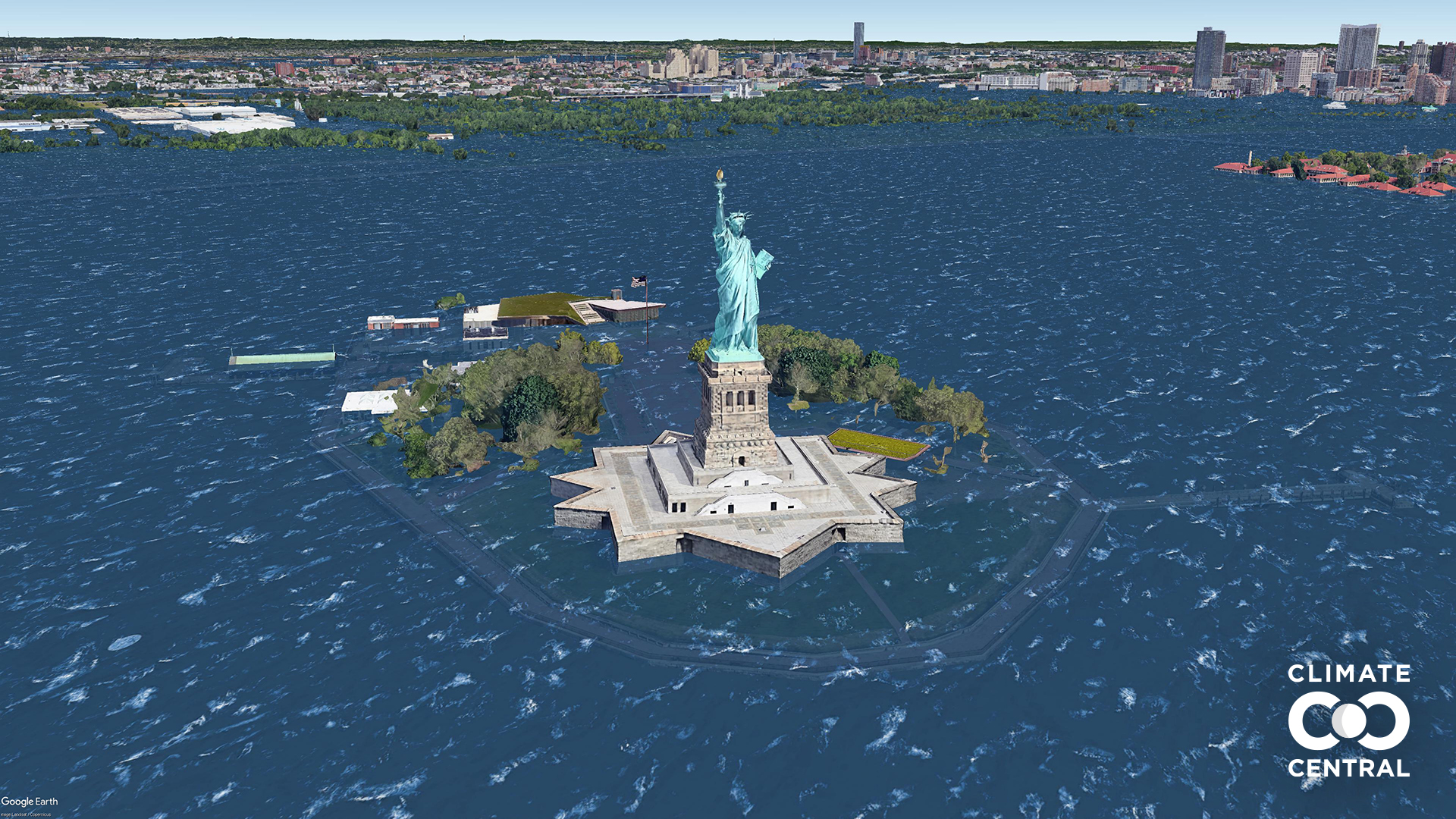
Here is an interactive map by NOAA that shows how rising sea levels will affect towns, cities and coastal regions. Adjust the water level height to see what each foot does to coastal land.
LeBoeuf warned that the cost will be high, pointing out that much of the American economy and 40% of the population are along the coast.
A Rutgers University scientist, who co-authored the NOAA report, said it's time to begin planning for the future with sea rise in mind.
"We have to be thinking about this in our communities and think about what is the future we want for our communities," Rutgers climate scientist Bob Kopp said.
Actions to lower carbon emissions taken in the years ahead won't stop the rising sea levels before 2050, but humanity could prevent some of the even worse effects projected after 2100, the report says.
Changing Climate
That's when the worst of the long-term sea level rise from the melting of ice sheets in Antarctica and Greenland probably will kick in, the report’s lead author, oceanographer William Sweet, said.
Warmer water expands, and the melting ice sheets and glaciers adds more water to the worlds oceans.
The report “is the equivalent of NOAA sending a red flag up" about accelerating the rise in sea levels, said University of Wisconsin-Madison geoscientist Andrea Dutton, a specialist in sea level rise who wasn’t part of the federal report. The coastal flooding the U.S. is seeing now “will get taken to a whole new level in just a couple of decades.”
“We can see this freight train coming from more than a mile away,” Dutton said in an email. “The question is whether we continue to let houses slide into the ocean.”
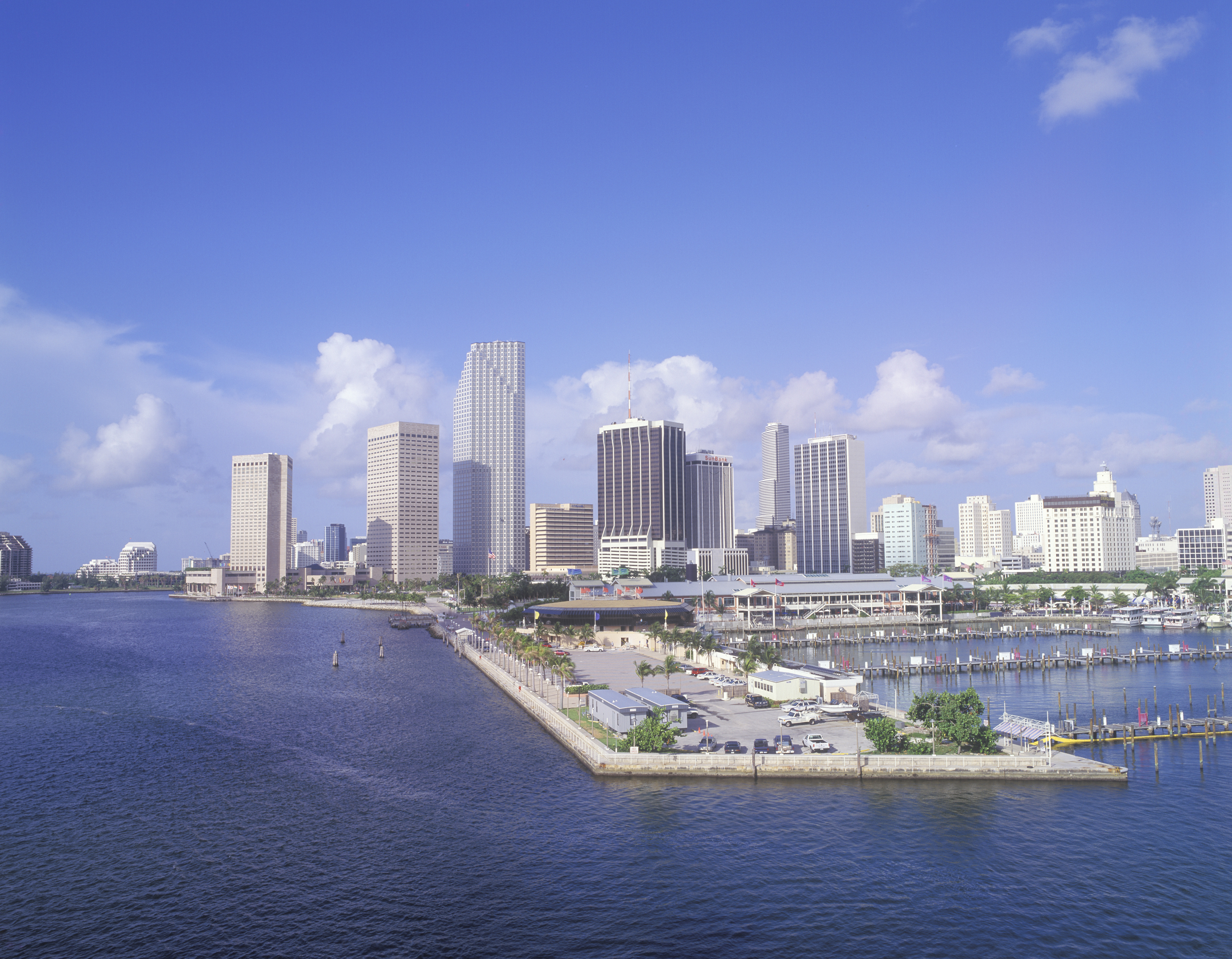
Sea level rises more in some places than others because of sinking land, currents and water from ice melt. The U.S. will get slightly more sea level rise than the global average. And the greatest rise in the U.S. will be on the Gulf and East Coasts, while the West Coast and Hawaii will be hit less than average, Sweet said.
For example, between now and 2060, expect almost 25 inches of sea level rise in Galveston, Texas, and just under 2 feet in St. Petersburg, Florida, while only 9 inches in Seattle and 14 inches in Los Angeles, the report said.
While higher seas cause much more damage when storms such as hurricanes hit the coast, they are becoming a problem even on sunny days.
“It’s going to be areas that haven’t been flooding that are starting to flood,” Sweet said. “Many of our major metropolitan areas on the East Coast are going to be increasingly at risk.”
And that’s just until 2050. The report is projecting an average of about 2 feet of sea level rise in the United States — more in the East, less in the West — by the end of the century.
