
Editor's Note (June 27, 7:58 a.m.): This story is no longer being updated on Tuesday. For the latest on the threat of more storms, click here.
Severe storms slammed the region on Monday, bringing tornado warnings across our northern counties during the afternoon and heavy rain, lightning, wind and flash flood warnings throughout most of our area at night.
Get Philly local news, weather forecasts, sports and entertainment stories to your inbox. Sign up for NBC Philadelphia newsletters.
Tornado warnings during storm
A tornado warning was in effect for Northampton County until 3:30 p.m. as well as parts of Berks and Lehigh counties until 2:45 p.m.
Weather Stories

People in the areas of New Tripoli, Kempton, Lenhartsville, Lynn and surrounding communities were urged to seek shelter in a basement or room with no windows. Route 309 was in the area under the threat.
Even after the tornado threat left, a flash flooding threat remained with parts of Berks and Lehigh counties under a warning until the early evening. A flash flood warning remained in effect for Chester, Delaware and New Castle counties until 10:45 p.m. as well as Lehigh and Northampton counties until 11 p.m.
You can track the storms with our live interactive radar:
Parts of Berks and Lehigh counties were also under a severe thunderstorm warning Monday afternoon. That alert, which has since expired, followed earlier alerts in the morning.
By early afternoon, a severe thunderstorm watch was issued for much of the region.
First Alert for thunderstorms, flooding, isolated tornado
A First Alert for severe storms with the potential of damaging winds, hail, flooding rain and isolated tornadoes remained in effect for Philadelphia, the Lehigh Valley, Pennsylvania suburbs, South Jersey and all of Delaware until midnight.
Multiple storms, some turning severe, impacted the Pennsylvania suburbs Monday evening and night.
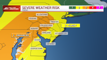
Much of the region, including Philadelphia, Trenton, Wilmington and the Lehigh Valley was under an "Enhanced" risk for severe weather Monday.
Steamy conditions throughout Monday added fuel to the thunderstorms in the afternoon and night.
By Monday night, lightning and thunderstorms moved through the Philadelphia area and surrounding suburbs. A Severe Thunderstorm Warning was in effect for most of the region until 11:15 p.m. Storms brought lightning, thunder, heavy rain and gusty winds to most of the region throughout the night and even caused trees to topple in parts of our area.

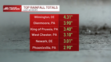
Just check out how much hail and rain fell on some neighborhoods. Some spots got more than 4 inches of rain in 48 hours!
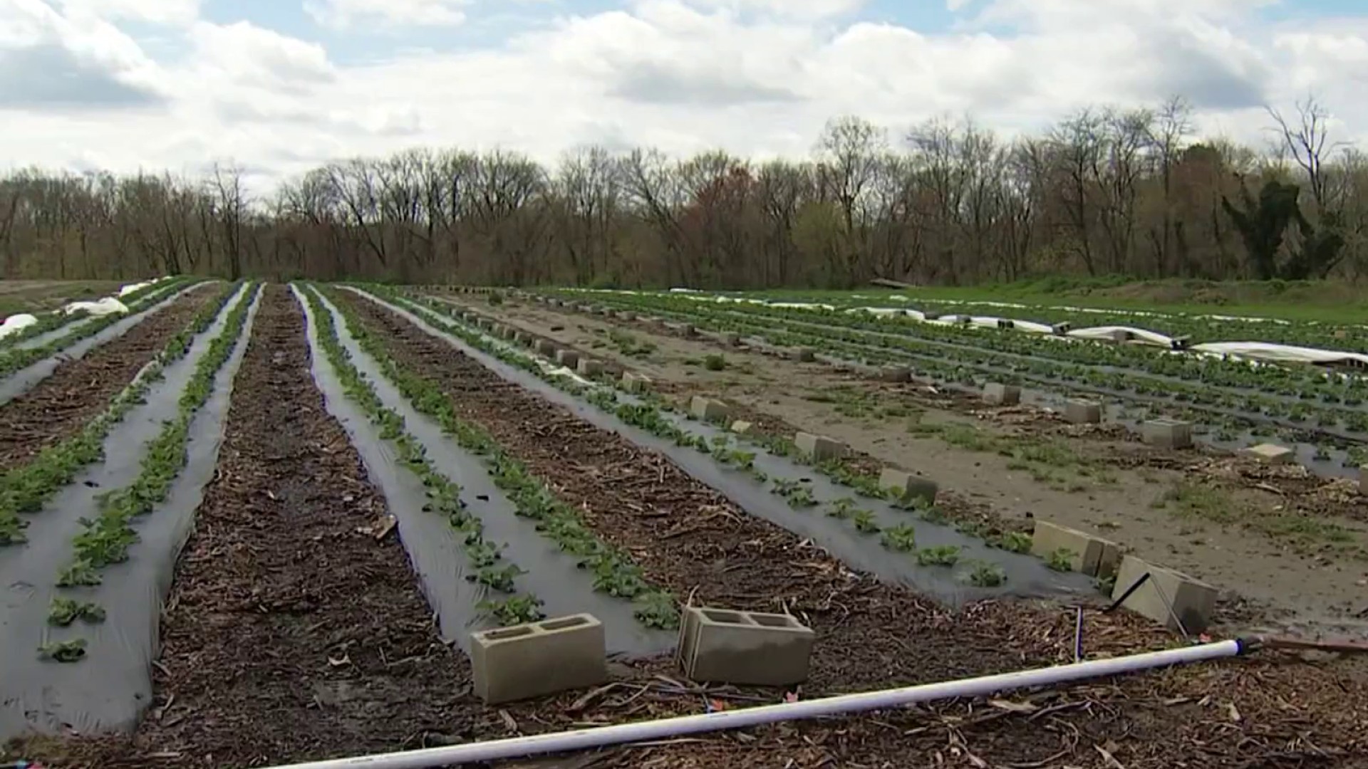
Flooding threat
The storms also packed downpours that led to flash flood warnings for parts of the region throughout the night.
The storms began to move out late Monday night into the overnight hours.
Be weather aware
Be sure to have the most updated version of the NBC10 app downloaded so you can get weather alerts sent to your device.
Should you be in the path of a tornado warning, seek shelter immediately in a basement of interior room with no windows until the threat passes.
People should make sure to weigh down outdoor furniture and trashcans. You should also be prepared for possible power outages.
Sign up for our Breaking newsletter to get the most urgent news stories in your inbox.
