


NBC10 First Alert Weather meteorologist Krystal Klei explains that we are in for a wet and messy Morning morning with icy conditions in some parts of the region.
UPDATE: Overnight snow fell through the Lehigh Valley and Berks county, with a rain to snow mix near some of the Pennsylvania suburbs. As forecast, the rain-snow line quickly pushed north through the early a.m. hours as warmer air wedged into the region following a warm front. As temperatures quickly boosted above freezing from south to north, all precipitation in the region switched to rain.
The NBC10 First Alert Weather Team issued a First Alert for the threat of snow, sleet, ice or rain depending on your neighborhood overnight into Monday morning.
It was mostly cloudy Sunday afternoon. A low pressure system and an associated warm front and cold front impacted the entire region and will continue into Monday morning.
A line of very light snow flurries moved across the area from west to east Sunday morning, and moved out around 11:30 a.m. It was spotty in nature, with some areas not seeing the snow actually make it to the surface.
Local
Breaking news and the stories that matter to your neighborhood.


Here's the timing of the system:
More consistent snow began late morning and early afternoon along the Lehigh Valley and Berks County, but driving concerns develop overnight and through the Monday morning commute as accumulation occurs. The snow was in and out through the afternoon, but there was some accumulation in the Lehigh Valley.
A warm front quickly drew in warmer air to the region, which led to a changeover fairly quickly from snow to rain. The rain began between 11 p.m. and midnight near New Jersey, Delaware and Philadelphia.

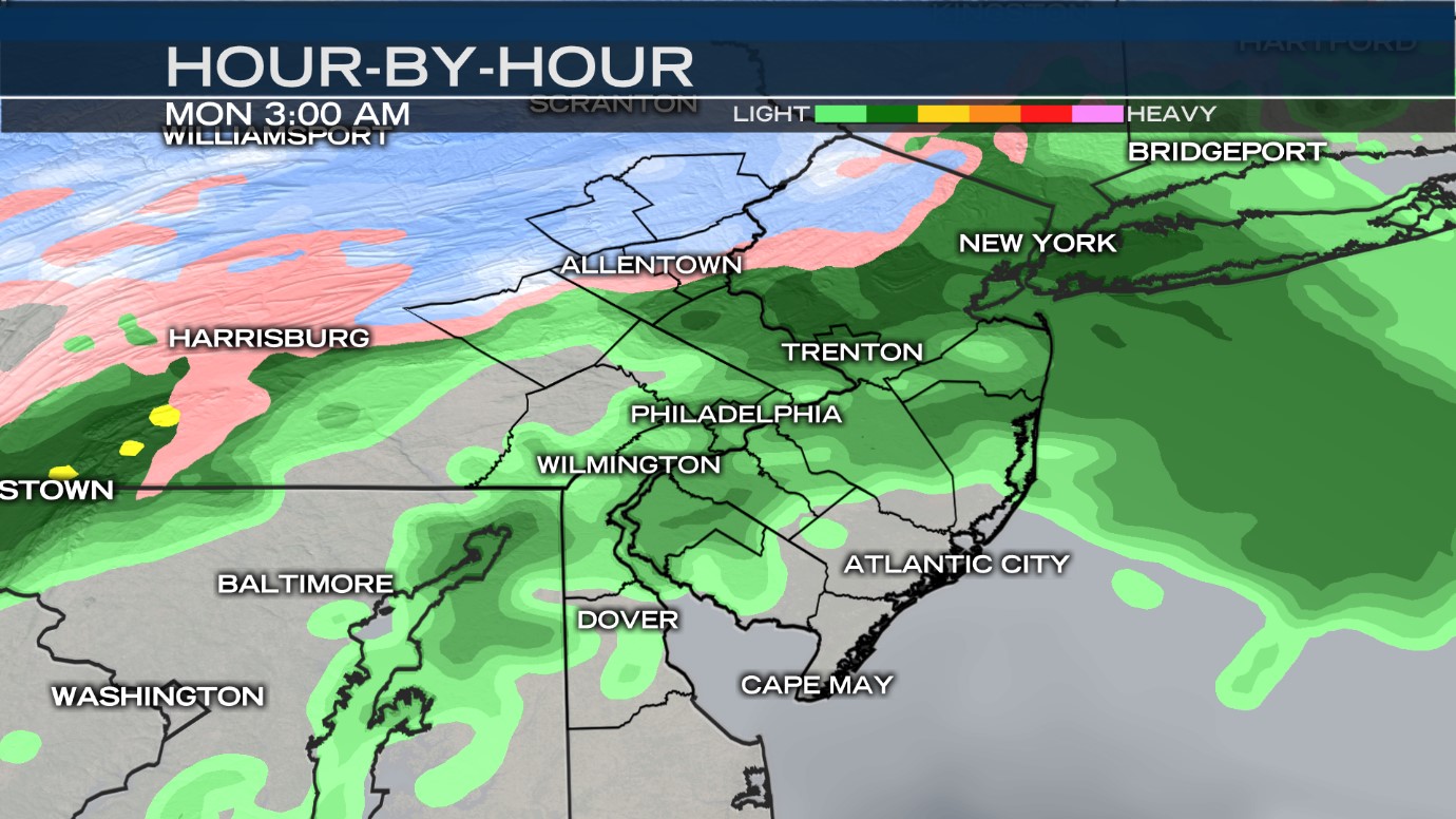
From midnight to 4 a.m., the rain snow line that originates over the suburbs will quickly force north. This will lead to some potential for a quick icing event along roads and foliage as the warm air shifts into the area.
Snow is most likely to linger near the Poconos and Lehigh Valley until 4 to 6 a.m., but the changeover to rain will completely engulf the region by 6 a.m.
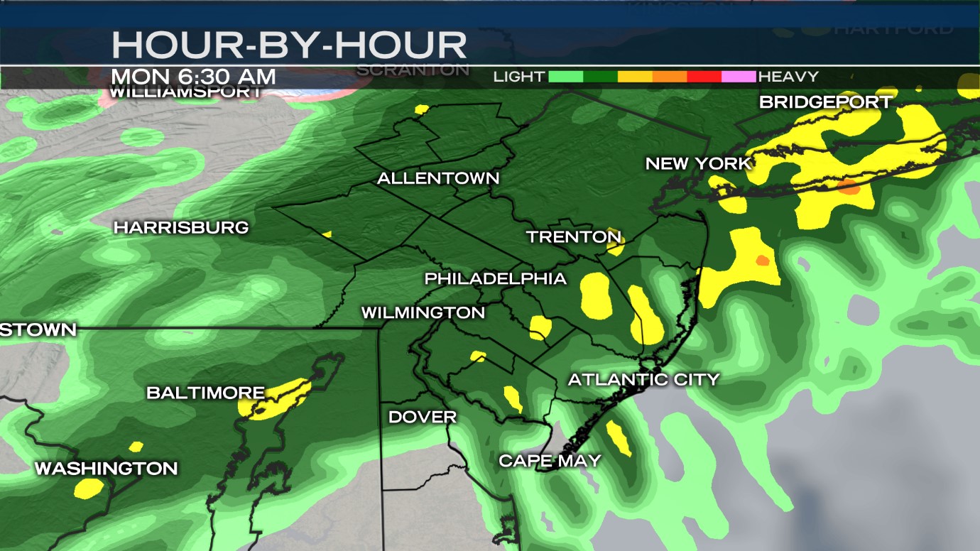
Some icy spots along I-78 and north may continue, which leads to danger for driver in the Lehigh Valley and Berks through the morning rush.
When the snow has completely moved out, snow totals are expected between 1-3 inches accumulation for the Lehigh Valley, slightly higher for the Poconos, and a coating to 1 inch for the northern suburbs.
Rain will slowly move out beginning northwest and tracking to the southeast from 8 a.m. to 11 a.m. The afternoon should be mostly dry with just isolated showers across the area.
The First Alert will be lifted by 9 a.m., but a wet commute across the board should be expected with a higher potential for danger north and west of Philadelphia, as well as along the northern edge of Mercer County and farther north.

