


While Sunday will bring sunny and dry weather to our region, the beginning of the work week could be a different picture. NBC10 First Alert meteorologist Krystal Klei is tracking a possible nor’easter that could impact our region.
The 3rd and final storm, in what has been a parade of strong March weather systems, is posing challenges to our weather forecast. There continues to be a great deal of uncertainty in regards to the storm’s impacts. Over the last 24 hours, we have seen some dramatic changes in the storm’s projected track. The track is critical because it will determine how much snow, if any, will accumulate in the Delaware and Lehigh Valleys, Jersey and Delaware beaches, and the Poconos.

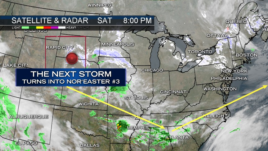
Right now the storm, which will span a giant Atlantic Ocean nor’easter, is spinning through the state of Nebraska. The storm is rather potent, and is now over an area of the United States where it will be better sampled by weather instrumentation that will be fed into our computer models. This should allow increasing levels of certainity in regards to track.
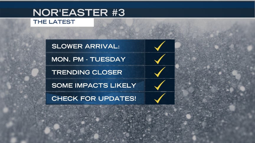
Several important changes have occurred since our last update. The storm’s arrival time is slower. The direct or indirect impacts will now be felt Monday evening through early Tuesday afternoon, which is later than the original Sunday evenign arrival time. The latest trends continue to be closer to the coast with the forecast track, which will deliver us at least some impacts. The greatest impacts right now are projected to be at the coast, where a light to moderate snowfall is likely. Since the storm’s track is so uncertain, everyone needs to be following the forecast extremely closely. A shift to the west or east will drastically change the storm’s projected impacts to our area. A shift further east would reduce snowfall, while a shift further west would increase snowfall amounts across the area significantly.
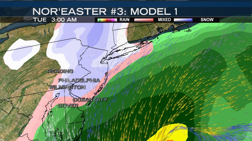
The American Model (GFS) above has shifted dramastically north this afternoon from where it was last night. This would incrase the odds for a couple of inches of snow as far north as southeastern PA, including south Jersey and Delaware.
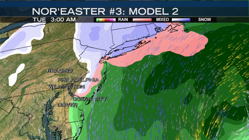
Even the European model (above) made a shift NW this afternoon, bringing light snow toward the coast. If this track were to verify, then not much snow would be see across inland spots.
[[476468973, C]]
Local
Breaking news and the stories that matter to your neighborhood.


Some of our higher resolution, short-term models (3 kilometer North American Model above) bring an even closer storm track with more in the way of intense snowfall.
With so much disagreement in our models, we cannot confidently communicate the impacts from this storm at this time. We can tell you that there will be likely be at least some impact, but the severity may shift up or downward, once we get a better fix on the storm’s projected path. That will likely happen Sunday morning or afternoon. We encourage you to check back for the latest!

