


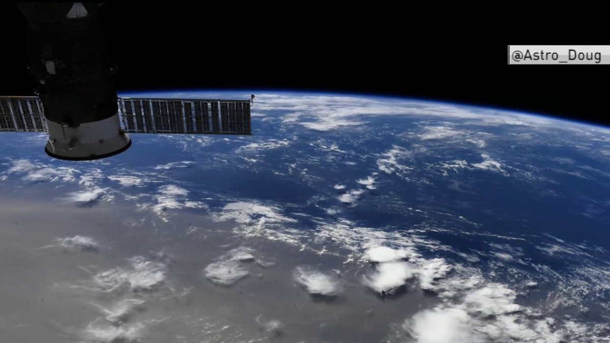
A giant dust cloud from the Sahara desert is now moving over the Caribbean. The cloud is so large it can be seen from space. What’s causing it and will it reach our area? NBC10 First Alert Weather meteorologist Steve Sosna explains.
The environment seems to be trying to tell us something: so far in 2020, we’ve had the emergence of murder hornets, paralyzing locust swarms in parts of the Middle East and Africa, and now the largest Saharan dust plume in over a half of century beginning to spread over the western Gulf Coast.
This intense cloud of dust is known for obscuring the sun during the brightest times of day, cooling temperatures and creating dangerous air quality for millions breathing the air from western Africa to the southern United States.

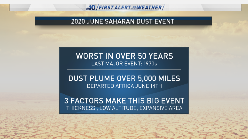
While Saharan dust storms are common this time of year, the one occurring now is not average by any means. This dust plume emerged off Africa June 14 and traveled westward like a firehose of water across the Atlantic Ocean.
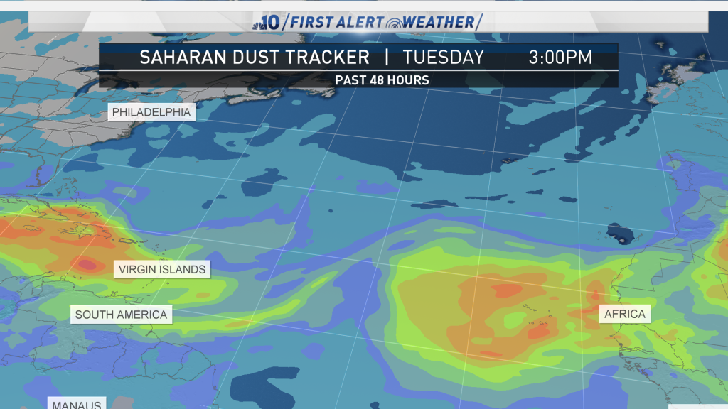
The dust first blanked areas including the U.S. and British Virgin Islands this weekend and continued surging east, covering Cuba. It's now making its way onto land across the Gulf Coast of the United States.
It's now traveled up to 5,000 miles. It's gargantuan in circumference and tall; the dust stretches as high as 20,000 feet and drops all the way down the ground like a curtain. This particular event has a lot of dust at low altitudes, making it more dangerous than some of the average dust storms because millions are breathing in air that's of poor to dangerous quality.
Air quality is the cloud's biggest threat to humans, especially those with respiratory illnesses such as asthma and pneumonia. During the COVID-19 pandemic, COVID hot spots including Houston and other parts of the southern United States will experience unhealthy and poor air quality, exacerbating the pandemic's impact. People with any kind of respiratory illness or weakness should limit and avoid extensive time outdoors over the course of the next several days as the dust cloud hooks east from Texas and surges toward Virginia, Georgia, Florida, and the Carolinas.
In addition to poor air quality and thick haze, another negative phenomenon that occurs is “brown rain”. This is when dust particles mix and bind to water droplets and fall from the sky. This “brown rain” is possible this weekend across portions of the southeast during routine afternoon and evening thunderstorms.
Local
Breaking news and the stories that matter to your neighborhood.


Surprisingly, these Saharan dust storms provide some benefits. They carry hot, dry air with them, which suppresses hurricane activity in the Atlantic Ocean, sometimes for weeks at a time. They also have the ability to create brilliant orange, fiery sunrises and sunsets in areas where haze isn’t too thick, restricting visibility. That's because the dust particles help scatter light when the sun hits the earth at low angles during dawn and dusk. These storms also spread blankets of micronutrients onto land and into the ocean as they spread out, sparking new life and enhancing ecosystems.
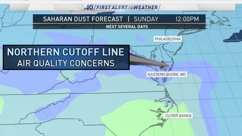
While the greatest concentration of dust will pass to our south, the northernmost edge will reach the southern part of Maryland Sunday afternoon and evening. And there could be enough dust particles in the air to enhance the sunset Sunday evening across southeastern Pennsylvania, including Philadelphia, New Jersey, and Delaware.

Sunset is at 8:33 p.m. Sunday, so look toward the western sky for a potentially thrilling and gorgeous sunset. The dust is expected to push offshore Sunday night.
Another intense surge in Saharan dust across western Africa now may take a similar path and arrive across the Gulf Coast of the United States in about a week.

