
Early morning storms moved out of the greater Philadelphia area Wednesday morning, but some problems will persist later in the day.
A First Alert for strong to severe storms ended at 6 a.m., but though the moisture will mostly clear out the rest of the day, there will be a chance of showers or even an isolated thunderstorm for some areas early in the afternoon.
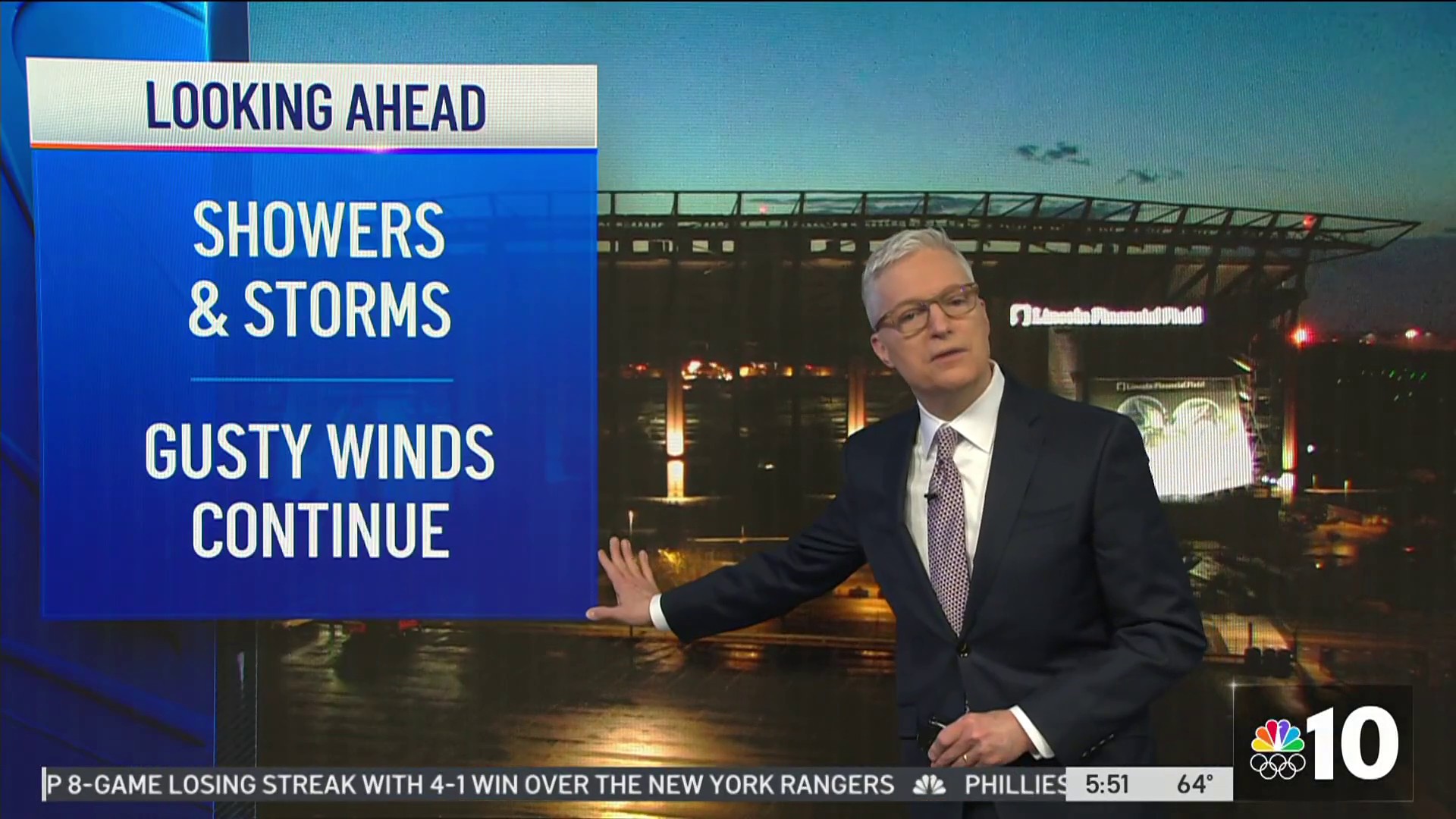
Heavy rain, lightning, damaging winds and hail posed the biggest threats early in the morning as clusters of showers and gusty thunderstorms slid across the area from north to south.
Things won't be as severe later in the day, but Philadelphia and areas north will likely get more rain around 1 p.m., while the Jersey Shore and Delaware will also get another round between 2 and 3 p.m.
The system is part of a stormy period across the area from Tuesday night into Thursday as rain could fall during that period as temps remain warm in the 60s and even 70s.
The warm weather will last through the day Thursday, but a strong cold front will move through in the afternoon. Another round of showers and thunderstorms is likely with that front. Then gusty winds bring in much colder air.
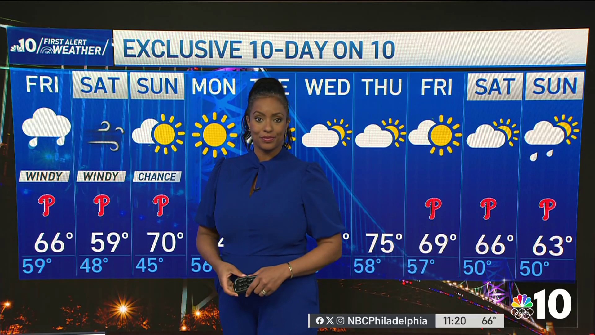
Temperatures Friday will struggle to get to 50 degrees. And it will get down to the 30s Saturday morning. There’s even a chance of a hard freeze in some areas at that time.
Stick with the First Alert Weather Team on air and in the NBC10 app for the latest on the storms.
