
What to Know
- Snow fell on the Philadelphia region early Friday morning as a fast-moving winter storm rolled through the region.
- The snow was mostly gone and the skies cleared as people cleared sidewalks and driveways later on Friday morning.
- Up to several inches of snow fell. Get details on that below.
Hundreds of schools closed, delayed or went virtual Friday. See the full list of school closings, virtual learning here.
Another round of snow moved through Philadelphia-area neighborhoods quickly Friday morning, leaving as the morning commute was under way
The snow, as expected, didn't dump major snow accumulation like Monday's storm did in parts of New Jersey and Delaware. But, people still had to shovel out in many neighborhoods, with some places getting around half a foot.
Get Philly local news, weather forecasts, sports and entertainment stories to your inbox. Sign up for NBC Philadelphia newsletters.
The NBC10 First Alert Weather Team issued a First Alert for the entire region that expired Friday morning.
Snow Across the Region, Slow Roads, Snow Emergency
It appeared a general 2 to 5 inches of snow fell across the Philadelphia region. There was a narrower heavier band of 3 to 6 inches across parts of South Jersey as the storm quickly intensified as it moved offshore.
Untreated roads or sidewalks became slippery, and that likely caused a slow morning commute Friday.
Crews were out treating major roadways overnight and expect slower speed limits on major roadways like the Pennsylvania Turnpike, Atlantic City Expressway and Schuylkill Expressway. Check out NBC10 First Alert Traffic reporter Sheila Watko's full list:
PennDOT lifted its speed restrictions on Pennsylvania roads before 9 a.m.
Many side streets and less busy roads weren't immediately treated.
PATCO riders should expected a special snow schedule Friday, the transit agency said. And, Philadelphia International Airport told travelers to expect delays and cancellations.
The snow was not as heavy or long-lasting as what was seen Monday in New Jersey and Delaware.
However, school delays or closures were announced. Before the first flake fell on Thursday, the Philadelphia School District announced it would hold all learning remotely due to Friday's snow.
Gov. Phil Murphy also declared a State of Emergency for New Jersey that went into effect at 10 p.m. Thursday.
In Delaware, states offices will open at 10 a.m. and non-essential workers shouldn't show up for work until then.
Other local municipalities could declare snow emergencies. If you need to go to appointments or to any offices, call ahead of time to make sure they are open.
Snow Moves Out as Expected
The snow started to develop in most places around midnight. The peak of the snow hit while many people were sleeping.
Most of the snow weakened and started to exit before daybreak. As expected, it was mostly gone before 9 a.m. By Friday afternoon, skies should clear, but cold winds will be making it feel frigid.

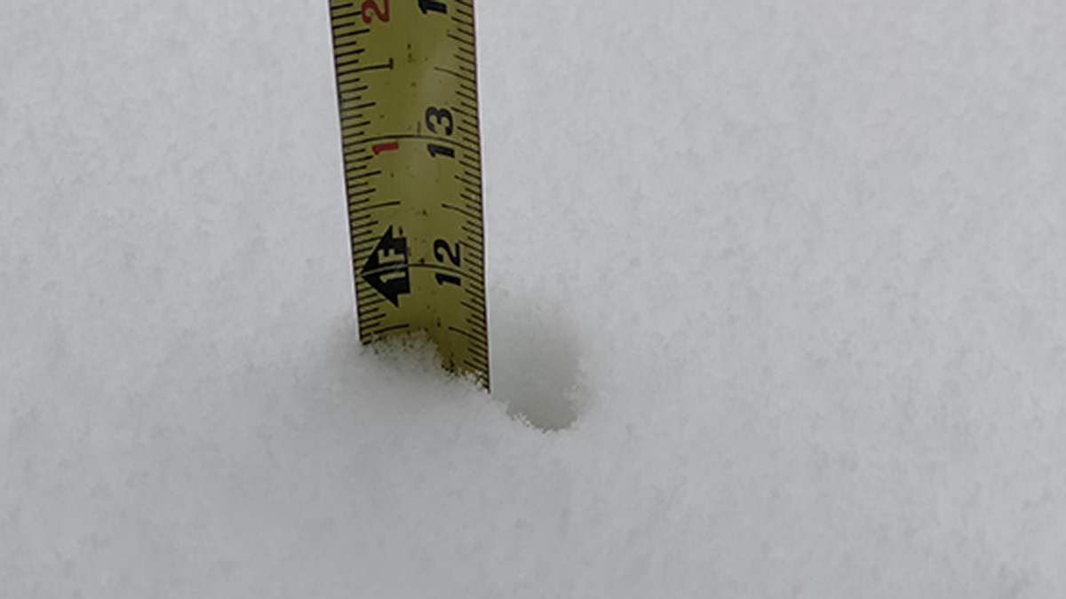
❄️ How Much Snow Fell?
While you may need to shovel some snow, totals weren't too high since the storm moved so fast. Totals around 2 to 6 inches were reported across the region.
By the time the snow moved out, at least 4 inches fell in Northeast Philadelphia, nearly 5 inches fell in Bucks County and at least 6 inches fell in parts of Burlington, Camden and Gloucester counties. Click here for full snow totals.
Of course, some places got more or less snow due to bands of heavier snow.
Whatever you got, be sure to clear if off during the daytime as temps will dip again overnight.
What About the Weekend Weather?
Expect a frigid Saturday morning with temps in the teens or even colder throughout the region. The high later in the day will struggle to get to freezing. You can expect to need to bundle up for Saturday night's Eagles-Cowboys game at Lincoln Financial Field in South Philadelphia. Wind-chills look to remain quite numbing in the upper teens and lower 20s.
Wet weather returns late Sunday morning and could start as freezing rain. However, temps will warm into the upper 30s and low 40s during the day, so expect mostly a rainy day.
Difficult travel still may take place Sunday, especially Philadelphia and points north and west for a few hours Sunday morning before temperatures inch above freezing, allowing existing ice to melt and the rest of the storm to be plain rain.
As always, keep ahead of any snow or wintry weather by making sure you have the latest version of the NBC10 app downloaded on your device.
