
Coastal flood warnings are in effect along the Jersey Shore for another day as a coastal nor'easter batters the Philadelphia region for the first half of our workweek.
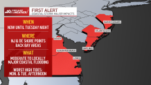
NBC10 First Alert Weather meteorologist Steve Sosna issued a First Alert for the Jersey Shore and Delaware Beaches through 9 p.m. Tuesday, as widespread moderate coastal flooding was expected to cause numerous road closures and possible travel disruptions, especially during Tuesday’s afternoon high tide cycles. The area of greatest concern for coastal flooding was not at the oceanfront, but in the back bay areas of the barrier islands.
Get Philly local news, weather forecasts, sports and entertainment stories to your inbox. Sign up for NBC Philadelphia newsletters.
The coastal flood warning was in effect for Atlantic, Burlington, Cape May and Ocean counties in New Jersey as well as Sussex and Kent counties in Delaware, including communities along Delaware Bay. Beach erosion was also a concern.
Many shore communities saw coastal flooding occur with Monday afternoon’s high tide. REMINDER: Don't drive through floodwater as your vehicle could get stuck and the salt water could damage your car.

The National Weather Service (NWS) also issued high surf advisories for New Jersey and Delaware beaches urging people to not go swimming or boating because of the dangerous conditions.
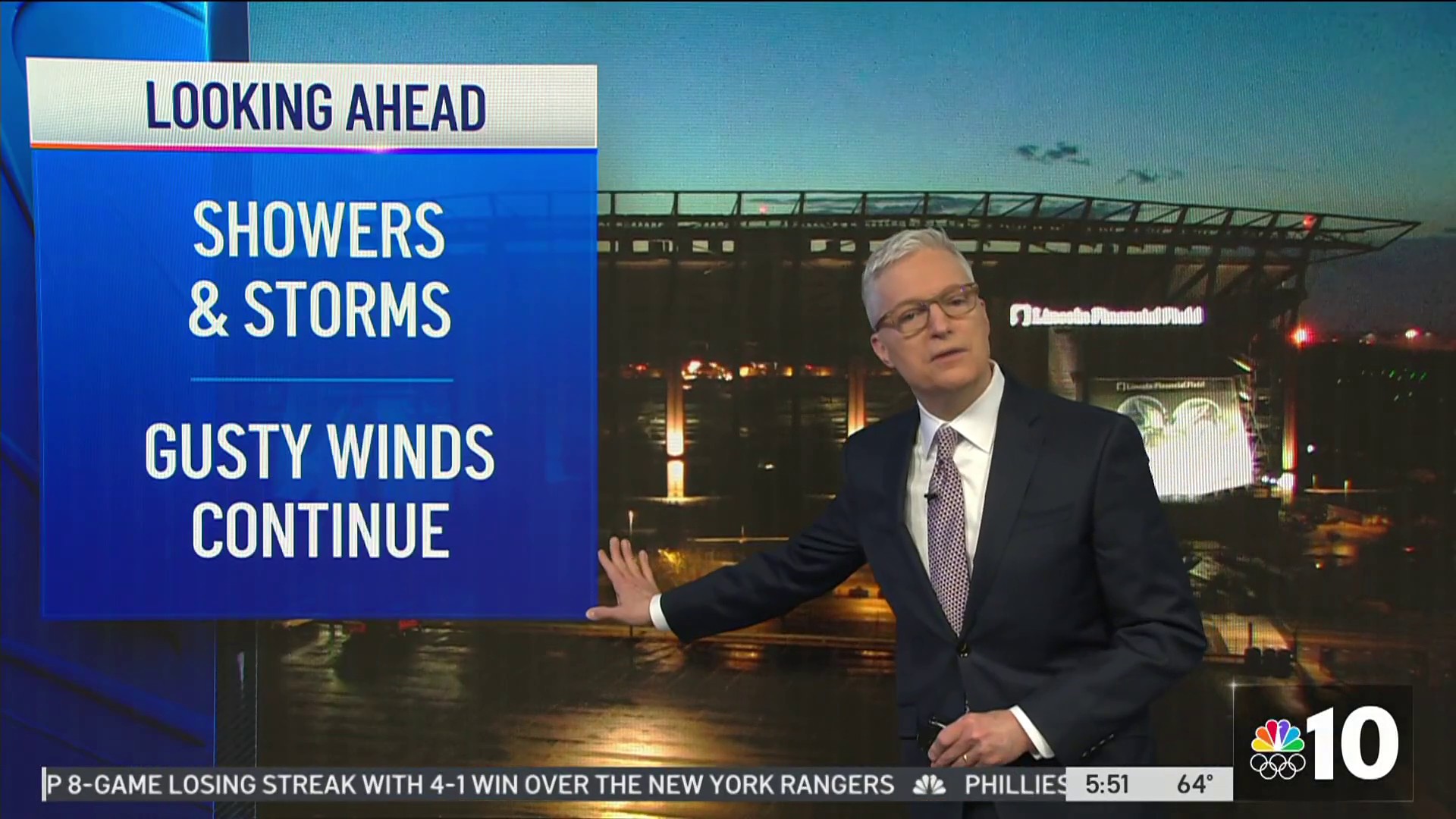
For inland areas, this coastal storm is delivering pockets of heavy rain with winds picking up later in the day. That windswept rain comes as temps hover unseasonably cold in the 40s and 50s.
This nor'easter came on the heels of the remnants of Hurricane Ian, which dampened the weekend in the Philadelphia region.
The impacts of the storm will be more intense closer to the coast in South Jersey and Delaware and less intense the further north and west you get from Philadelphia. It's going to feel wet and raw when you step outside Tuesday -- a shock to the system for sure.
Total rain accumulation From Monday to Wednesday morning is expected to be between 1 to 3 inches. This additional soaking comes after many places saw 1 to 2 inches of rain over the weekend. North and west of Philadelphia, across the suburbs and in the Lehigh Valley, the impacts won’t be as severe with less rain and weaker winds.
While rain and showers are in the forecast through Wednesday, there will be some drier pockets of weather where showers are isolated and mainly locations temporarily dry out. Steady rain is forecast to return Tuesday night and then slowly taper off Wednesday, which remains rather crummy weather-wise.
Some nuisance coastal flooding is expected Wednesday, but nothing like what happened Monday and Tuesday.
For the Philadelphia region, localized coastal flooding is possible along the Delaware River into Tuesday night, according to Sosna.
Click here to see the latest weather advisories near you.
As with any weather event, make sure you have the NBC10 app downloaded for the latest weather forecast and advisories from the First Alert Weather Team.
