
What to Know
- A First Alert was in effect for our entire area Wednesday but was lifted around 9:30 p.m.
- Strong storms with heavy rain, localized flooding and damaging winds hit the region during the afternoon and evening.
- The storms led to damage as well as power outages throughout the region.
Strong storms with heavy rain and powerful winds hit the area Wednesday, causing outages, damage and localized flooding. A First Alert was in effect for the entire region but was lifted around 9:30 p.m.
A cold front moved in, triggering some gusty thunderstorms in the afternoon and evening.
Flash flood and severe thunderstorm watches and warnings were issued throughout the day and evening for the entire area.
Heavy rain fell in neighborhoods like Bensalem, Drexel Hill, Ewing, Trenton, Willingboro and Yeadon. One inch of rain had already fallen in some places in a short period of time in the early afternoon, the National Weather Service said.
The storms led to thousands of power outages with PECO reporting more than 11,000 in our area Wednesday afternoon. By Wednesday night, the number was reduced to around 1,200.
Powerful winds from the storm blew the bleachers into the middle of the football field at Father Judge High School in Northeast Philadelphia. Fortunately no injuries were reported.
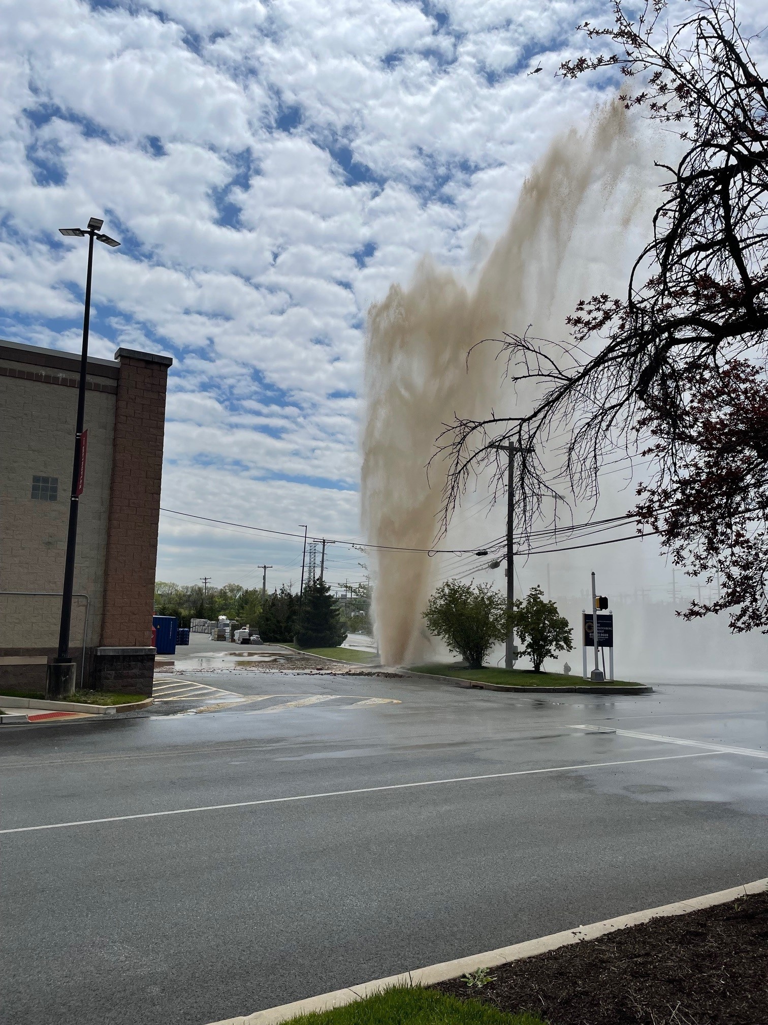
Storm damage, including downed trees and damaged homes were also reported in Philadelphia, Delaware, and Chester counties in Pennsylvania as well as Mercer County in New Jersey.
Local
Breaking news and the stories that matter to your neighborhood.

Arriving flights at Philadelphia International Airport were also delayed an average of an hour and 22 minutes due to the storms.
A pocket of storms already hit parts of the Poconos on Wednesday morning and another pocket hit the Philadelphia region during lunchtime. By 2:30 p.m. the storm had moved out of Philly and the sun returned, adding more potential fuel for more storms.
Storms returned later in the afternoon and could continue on and off through the evening.
Before the storms, conditions warmed and humidity built with highs in the upper 80s. Those conditions fuel storms.
Stormy weather could also put a damper on the start of the weekend as well, but should clear out by Sunday.
THURSDAY: Partly cloudy with an isolated shower. High in the upper 80s.
FRIDAY: Partly sunny. Scattered storms possible. High in the mid 80s.
SATURDAY: Partly sunny. A chance of showers. High in the mid 80s.
SUNDAY: Mostly sunny. High near 90.
Stay with the NBC10 First Alert Weather Team and download the NBC10 app for the latest weather updates.
