
Flooding left parts of South Jersey under water after storms dumped heavy rain throughout the region Tuesday into Wednesday morning.
Nearly 9 inches of rain fell in Millville, New Jersey (the second highest total ever) causing streets to flood late Tuesday night. A severe thunderstorm with heavy winds also struck the area Tuesday night.
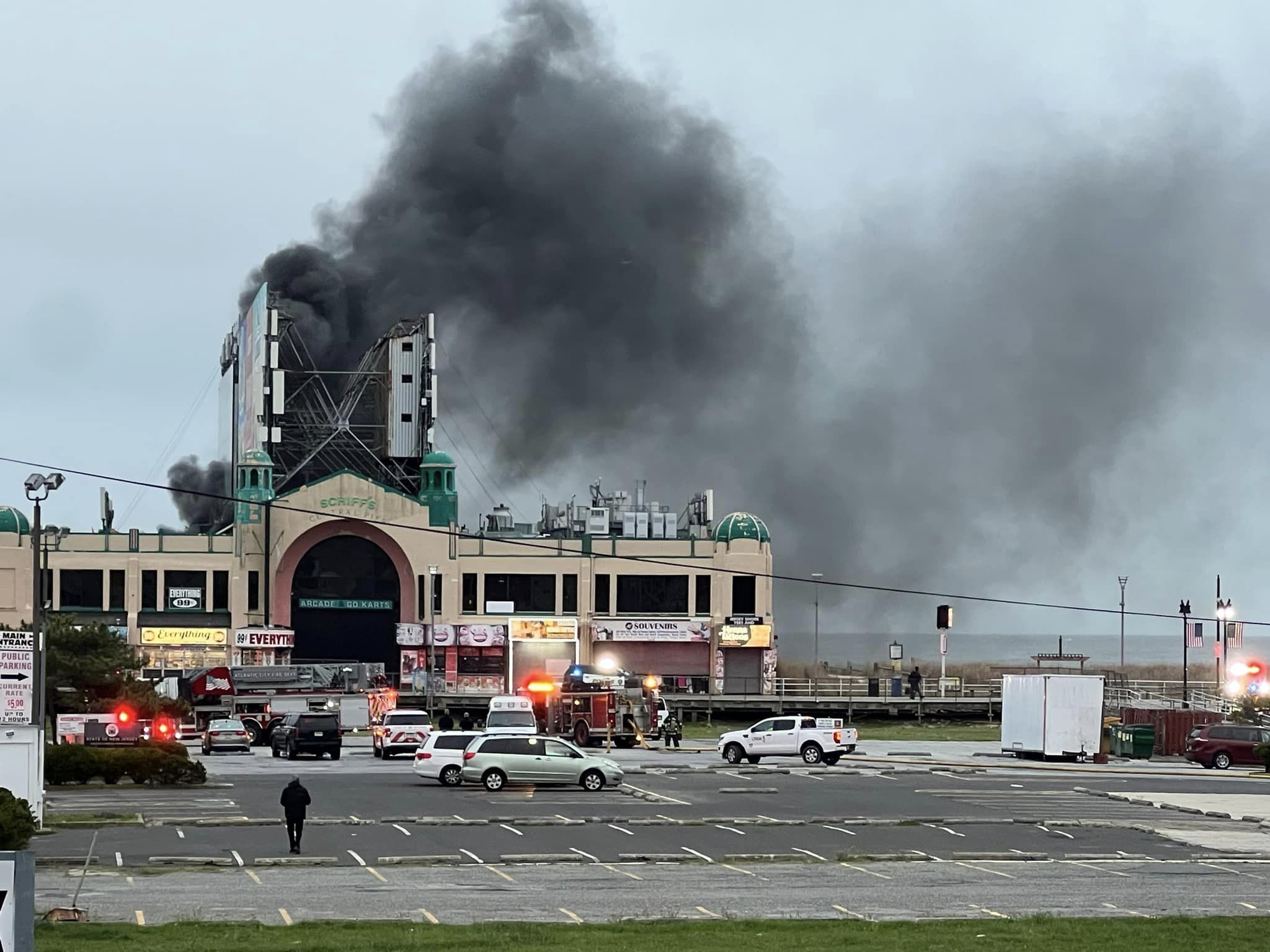
Crews also worked to stop gas leaks caused by the heavy rain.
- DOWNLOAD: NBC10 Weather App
"Radar estimates are over six inches as heavy rain has continued to move over the same area in Cumberland and Atlantic Counties this evening," said First Alert Meteorologist Sheena Parveen. "Localized street and creek flooding are likely."
The flooding forced several areas to evacuate in Millville overnight. Certain streets also closed due to flooding and a basement wall collapsed on a woman inside a home on Rhonda Drive. As the water began to recede overnight, some residents remained out of their homes.
The National Weather Service issued Flood and Flash Flood Warnings for parts of South Jersey. Those warnings were all canceled by 6:30 a.m.
There was more than 7 inches in Stafford, more than 5 inches at Atlantic City airport and in Manasquan, and more than 4 inches in Tabernacle.
Long Beach Island was also hard hit as Long Beach Boulevard was closed from 13th to 31st Street Wednesday morning due to flooding. Traffic also alternated along the causeway bridge in and out of LBI for hours until reopening Wednesday morning.
In Vineland, city officials blocked off part of Italia Avenue near Utopia Lane after the Menantico Creek overflowed.
Local
Breaking news and the stories that matter to your neighborhood.

Scattered showers continued into Wednesday morning across the region. By Wednesday afternoon, the rain should clear, giving way to sunshine and a high of 83.
We’re in for more sunshine and temperatures in the high 70s to mid-80s on Thursday, Friday and Saturday. On Sunday there will be a chance for late showers though heavy rain isn't likely.
